Post by Deleted on Apr 7, 2009 6:33:26 GMT -5
Here in Kent in the South-East of England where I live, as well as some architectural monstrosities, we are also blessed with some beautiful historical gems. Mocat showed you Leeds Castle near Maidstone a little while ago. Clipgate Farm where I fly my microlight is just south of Canterbury with its ancient city wall and beautiful cathedral and just north of Dover castle on the top of the White Cliffs over the famous harbour.
To the north-west of Clipgate is the ancient city of Rochester on the River Medway where Shorts built their flying boats. Rochester has a special place for me because it was at Rochester Airport EGTO where we kept VU, the Cherokee that I and four other friends owned in the 1980s. Rochester is also a lovely little city (unlike Strood the suburban monstrosity built right next to it) with another lovely cathedral and a beautiful old walled castle which hosts a fabulous Summer Arts Festival culminating in a superb open-air concert and firework display.
EGTO is on a sort of plateau which is the highest spot in the area, to the south of the city. To the north of the airfield the land is more or less level, eventually falling away to the city below. At the southern end, the land falls away in an almost sheer 80 or 90ft drop down to the M2 motorway, the main link from the UK to the Channel Tunnel and Europe. The M2 crosses the River Medway on a high viaduct to the south-east of the airport and passes it still rising from west to east. Anyone driving eastwards notices the long climb up but if they didn't already have knowledge of Rochester Airport, they would never be aware that it was there as it's impossible to see it from the motorway.
Unfortunately none of this is apparent in default FSX. We're lucky, though, because give or take a few minutes, the main features are there in more or less the correct relative positions so we have the power to correct them! But be ready for a disappointment. Sadly, EGTO is featureless except for the runways, which also are not quite right. Charles Watson did a nice little FS9 scenery but that, of course, is incompatible with FSX. I've been toying with the idea of making one myself for FSX but in any case, I thought I'd show what can be done with ADE for anyone who might be interested in playing around with FSX scenery design. In all of the following, the first shot is default, the second is after tweaking with ADE
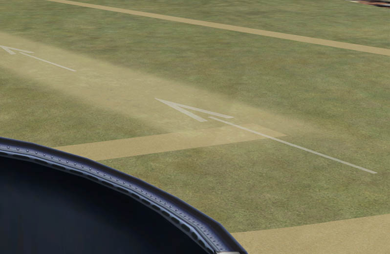
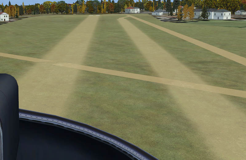
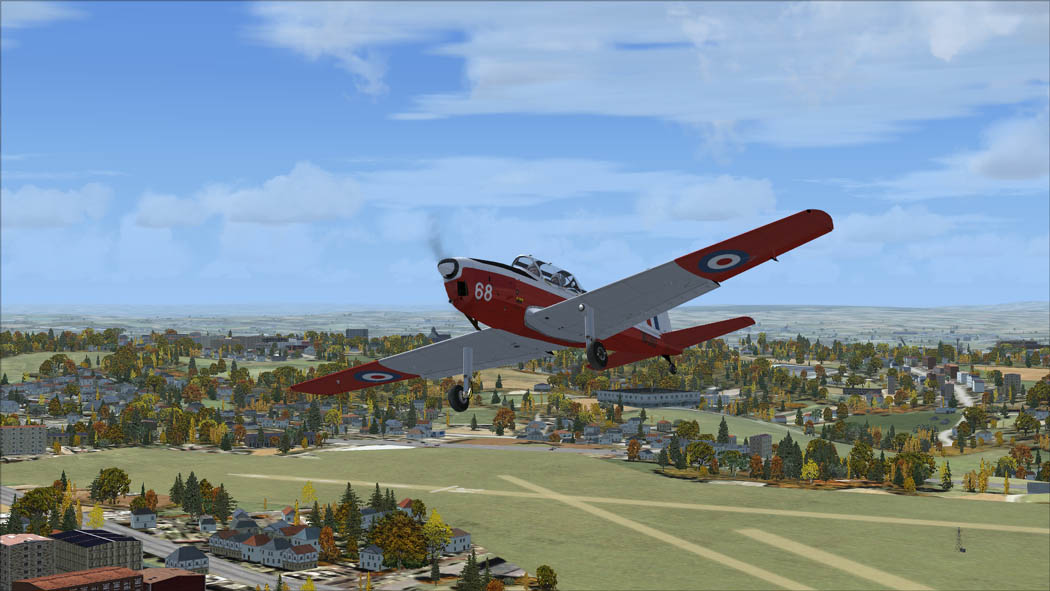
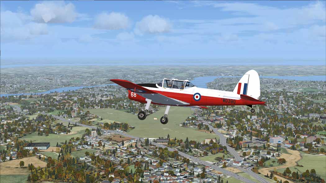
Shots 1 and 2
Notice how in shot 1 the road (see the traffic in the background) is on the same level as the airfield. Also the background consists entirely of autogen. In fact the area to the south of the airfield and the M2 is open countryside consisting of farmland, fields and woodlands. See how the problems in shot 1 have been corrected in shot 2

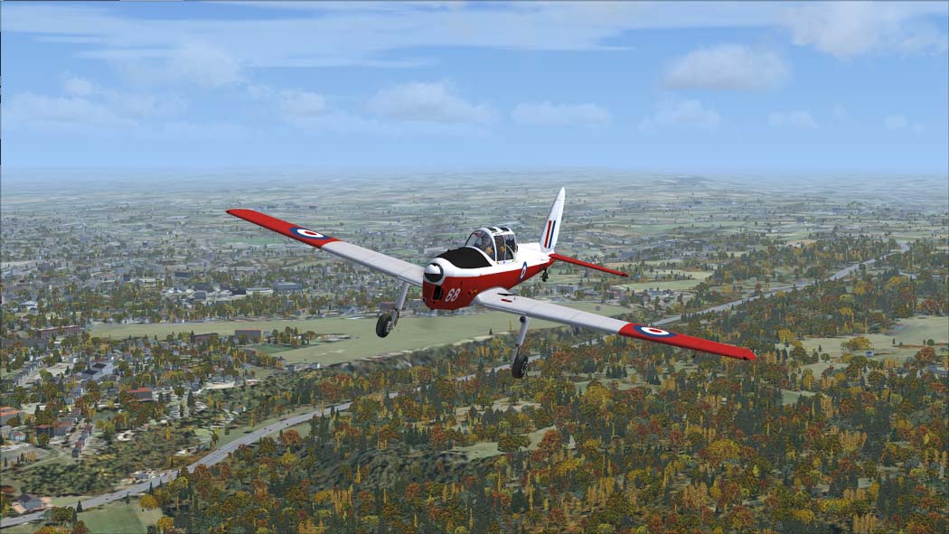
Shots 3 and 4
The changes are even more apparent in these two shots see how the M2 motorway has disappeared below the level of the airfield. Notice also how all the autogen has disappeared.

Shots 5 and 6
These shots again show fairly clearly how the levels have been successfully altered and the autogen removed. I also like how it's been possible to make the M2 fall from east to west as it passes the airfield.

Shot 7
This final shot shows how the changes have also managed to capture the long drag up from left to right from the River Medway in the west (not shown) to the mid-right of the pic, which is then at the level of the surrounding terrain.
So there you go - all done with ADE in a relatively short time. A very powerful tool which anyone interested in FSX scenery design needs to get to know. And one for which we have to thank our very own scruffyduck! Thanks Jon!!
To the north-west of Clipgate is the ancient city of Rochester on the River Medway where Shorts built their flying boats. Rochester has a special place for me because it was at Rochester Airport EGTO where we kept VU, the Cherokee that I and four other friends owned in the 1980s. Rochester is also a lovely little city (unlike Strood the suburban monstrosity built right next to it) with another lovely cathedral and a beautiful old walled castle which hosts a fabulous Summer Arts Festival culminating in a superb open-air concert and firework display.
EGTO is on a sort of plateau which is the highest spot in the area, to the south of the city. To the north of the airfield the land is more or less level, eventually falling away to the city below. At the southern end, the land falls away in an almost sheer 80 or 90ft drop down to the M2 motorway, the main link from the UK to the Channel Tunnel and Europe. The M2 crosses the River Medway on a high viaduct to the south-east of the airport and passes it still rising from west to east. Anyone driving eastwards notices the long climb up but if they didn't already have knowledge of Rochester Airport, they would never be aware that it was there as it's impossible to see it from the motorway.
Unfortunately none of this is apparent in default FSX. We're lucky, though, because give or take a few minutes, the main features are there in more or less the correct relative positions so we have the power to correct them! But be ready for a disappointment. Sadly, EGTO is featureless except for the runways, which also are not quite right. Charles Watson did a nice little FS9 scenery but that, of course, is incompatible with FSX. I've been toying with the idea of making one myself for FSX but in any case, I thought I'd show what can be done with ADE for anyone who might be interested in playing around with FSX scenery design. In all of the following, the first shot is default, the second is after tweaking with ADE
Shots 1 and 2
Notice how in shot 1 the road (see the traffic in the background) is on the same level as the airfield. Also the background consists entirely of autogen. In fact the area to the south of the airfield and the M2 is open countryside consisting of farmland, fields and woodlands. See how the problems in shot 1 have been corrected in shot 2
Shots 3 and 4
The changes are even more apparent in these two shots see how the M2 motorway has disappeared below the level of the airfield. Notice also how all the autogen has disappeared.
Shots 5 and 6
These shots again show fairly clearly how the levels have been successfully altered and the autogen removed. I also like how it's been possible to make the M2 fall from east to west as it passes the airfield.
Shot 7
This final shot shows how the changes have also managed to capture the long drag up from left to right from the River Medway in the west (not shown) to the mid-right of the pic, which is then at the level of the surrounding terrain.
So there you go - all done with ADE in a relatively short time. A very powerful tool which anyone interested in FSX scenery design needs to get to know. And one for which we have to thank our very own scruffyduck! Thanks Jon!!