
Post by luisfeliztirado on Aug 27, 2012 10:32:55 GMT -5
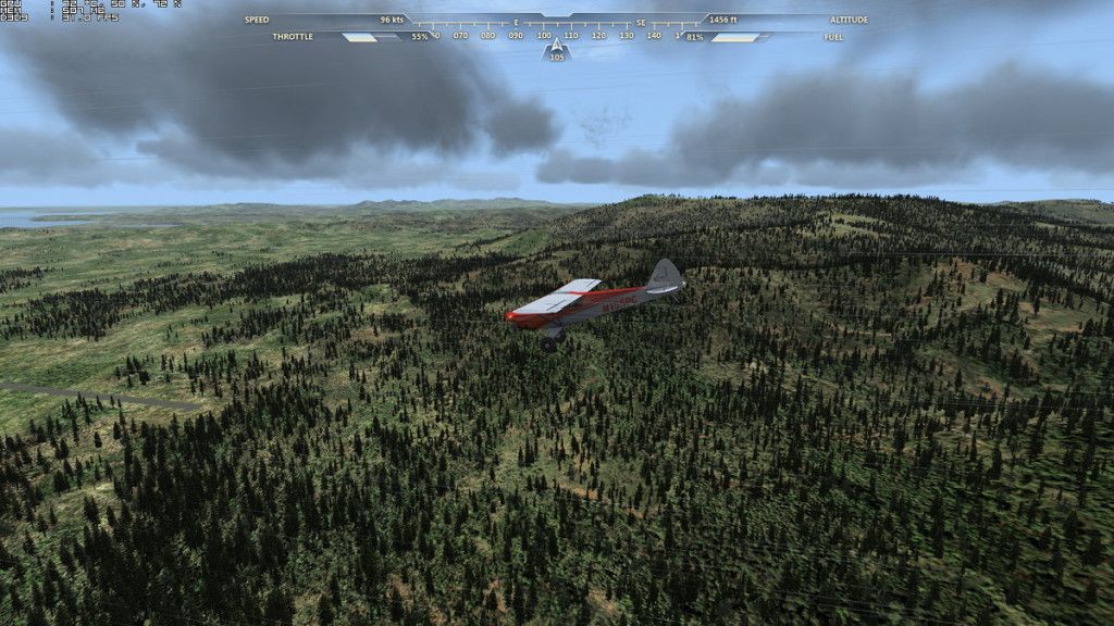
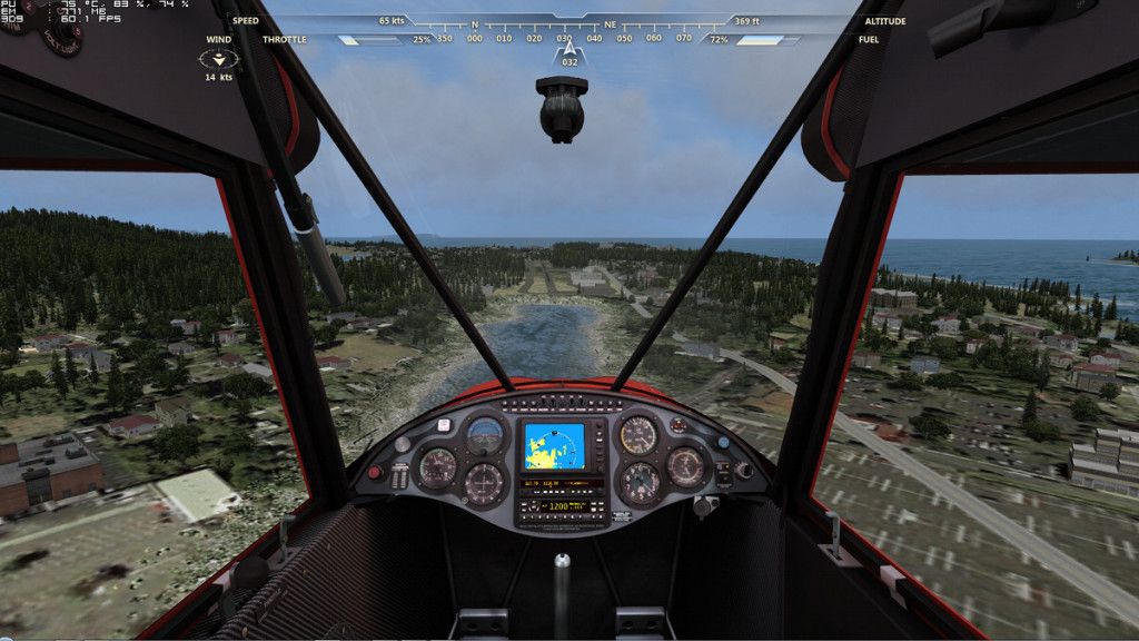
Occasionally, when flying around Alaska, I have found myself on Short Final with very tall trees dangerously blocking the threshold of the runway. For example, this is Kako just a little Northwest of Russian Mission.
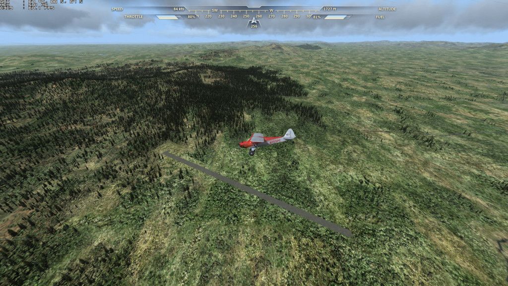
Not only are there trees, but also numerous hills, so the approach is somewhat steep. This isn't really a big problem with the Cub; it was made for that. But, I did notice in instances like this that often the other runway was clear of trees and other obstructions. Here is Kako from the other side:
Now, there have been some complaints about obstacles close to runways, but perhaps in some case it is simply a matter of choosing the right winds. With the correct wind for that part of Alaska, landings at Kako become (distressingly) easy.
And the same is valid for other places. This is Kodiak Municipal with the wrong Southerly winds that lead to landing over trees and buildings.
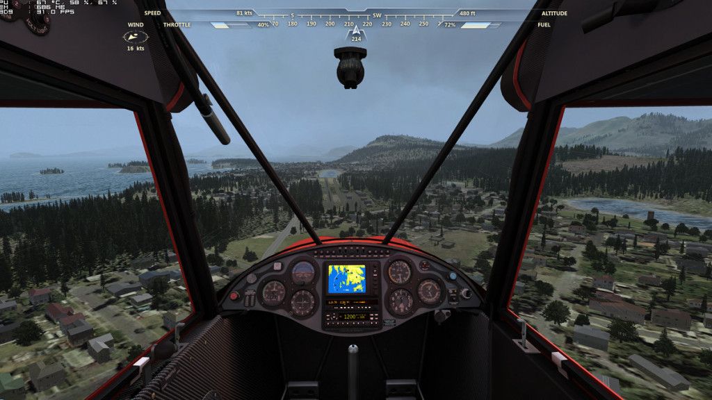
But, set the winds to the correct direction for this area, North/Northwesterly, and Short Final is over Lilly Lake (which, by the way, is the seaplane base) and landing is free of obstructions.
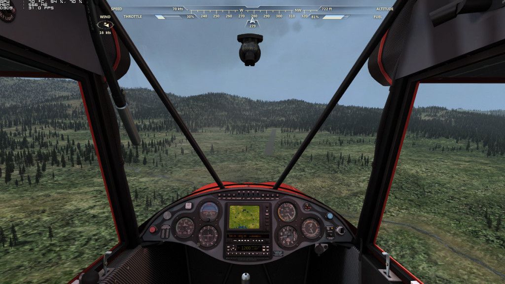
And one last example, Flying Crown, just because nothing in life is simple and straightforward. This strip is South of Anchorage and seems to be a private runway for the surrounding residents. The prevailing winds in Anchorage are nominally from the North, but then tall trees block the runway.
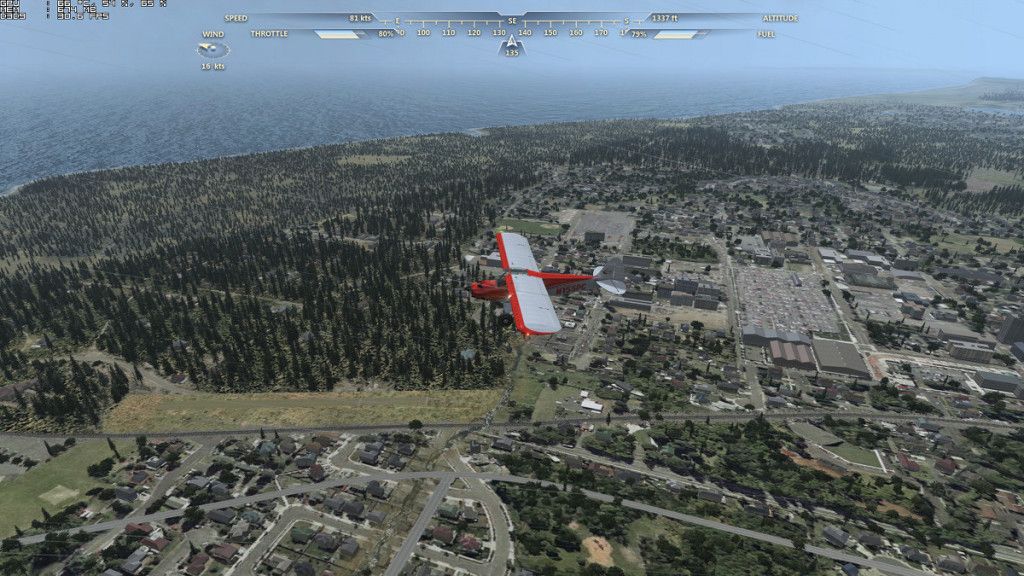
On closer study, winds in the area are from the North just half of the year, and during the Spring and Summer months they are from the South. So, set the winds differently and avoid the trees at Flying Crown.
(Just for your information, Flying Crown,from what I say in Google Street View, is surrounded by trees on all sides, so it's probably easier to take off and land there in Flight.)
And, of course, this leads directly to the question: what are the correct winds in Hawai'i and Alaska?
Well, Hawai'i is subject to the Trade Winds so we could expect them to be essentially from the Northeast. But, as I mentioned, life is never so simple. The majority of the islands do experience these winds, but the Big Island of Hawai'i has prevailing winds from the West/Southwest. And there are always monthly variations that can be different from the annual mean. Plus, coastal areas, and their airports, are subject to sea breezes in the daytime, and land breezes at night, that are often more important than the prevailing winds.
Generally, runways are laid out in such a way that they allow pilots to land with a headwind and as little crosswind as possible. So, just taking a look at the airport layout will usually be a good indication of prevailing winds.
But, it is always better to have more detailed and precise information.
Here is a table of prevailing winds in Hawai'i:
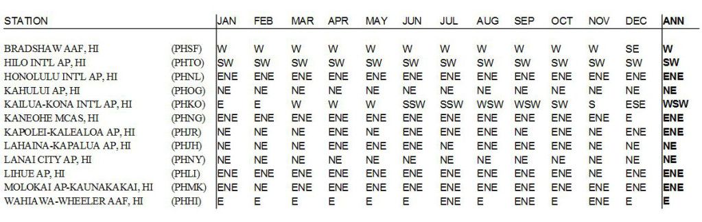
Source: Desert Research Institute - Western Regional Climate Center
www.wrcc.dri.edu/htmlfiles/westwinddir.html
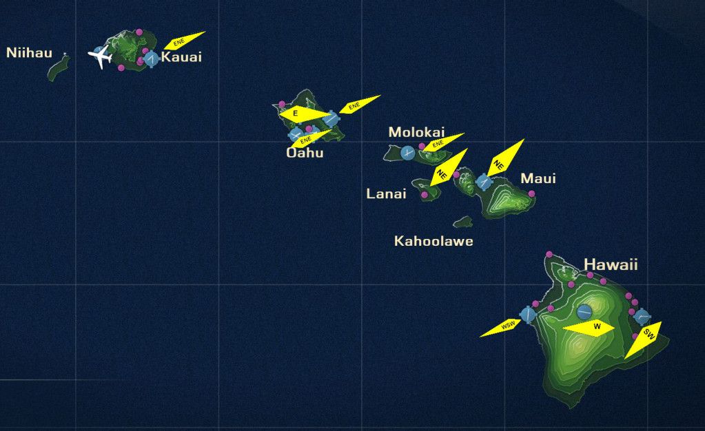
And an illustrated map of the annual prevailing winds for easier understanding:
And the similar table for Alaska:
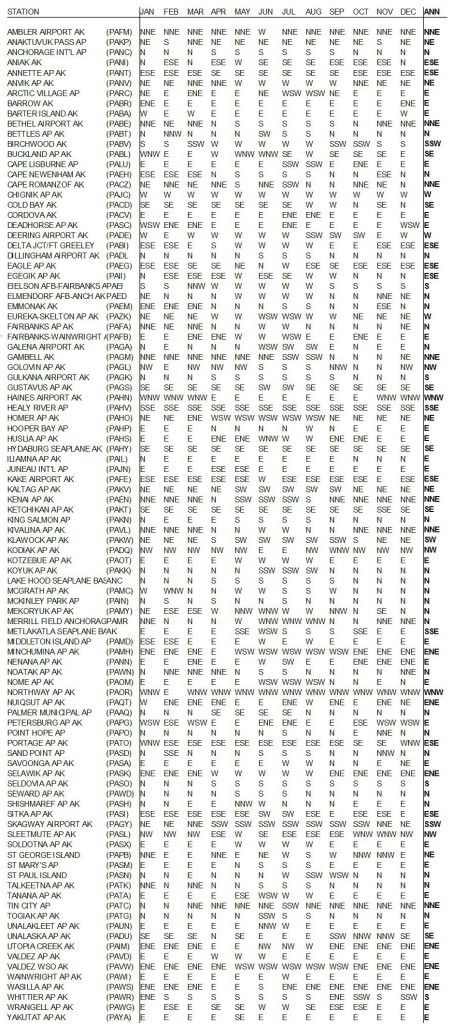
Source: Same as above
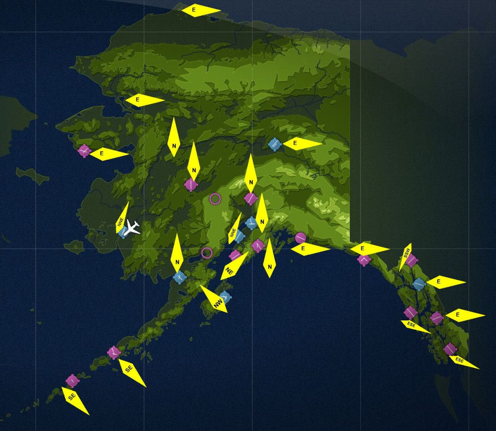
With the illustrated map of Alaska:
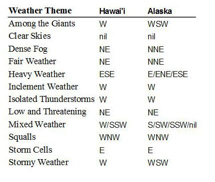
Well, that's good, now we know what the real winds are in each region, but how to set those winds in Flight? I did a very quick and imcomplete test of the various Weather Themes in both Hawai'i and Alaska and put together this simple table. It may or may not reflect all the conditions for each Theme, and the 2 new Alaskan Themes seem to have more variation than the original. But, for what it's worth, this table should give a good indication of the winds available in Flight:
So, if you are a "serious" simmer like me, then you will carefully plan your flights, examining the airport charts for both destination and arrival, and choosing the most appropriate Weather Theme.
If you will have any sort of crosswind, then you will want to take into account the Maximum Demonstrated Crosswind Component for the airplane of your choice. Now, first you have to be able to find out what it is, and that's not so simple, and then consider if you want to attempt to exceed that in case you have very strong winds. Also, remember that this is just a Demonstrated Crosswind, somebody, probably the test pilot, got up and flew in that crosswind to show it could be done.
I searched for the Maximum Demonstrated Crosswind Components for the principal airplanes in Flight, but only the Cubcrafters Cub has any indication of this in the Pilot Operating Handbook:
Carbon Cub - 11 kts
Yes, that's right, just 11 kts, so basically you will often exceed the Max Crosswind Component for the Cub.
Now, I could not find this speed for the other airplanes in Flight, but the FAA does stipulate that aircraft must be able to handle at least a crosswind representing 20% of Vso, (90° crosswinds up to a velocity equal to 0.2 Vso. This means a windspeed of two-tenths of the airplane’s stalling speed with power off and landing gear/flaps down), so here is Vso for the Flight airplanes:
Maule M7-260C Orion - Max Crosswind 12 kts (14 mph) Vso 40 mph
Stearman PT-17 - Vso 55 mph (48 kts)
RV-6A - Vso 45 kts
Icon A5 - Vso 45 kts (but who knows what this will turn out to be, since the airplane is still in development)
So, now you know what we must do, all us "serious simmers", in order to fly like the real thing.
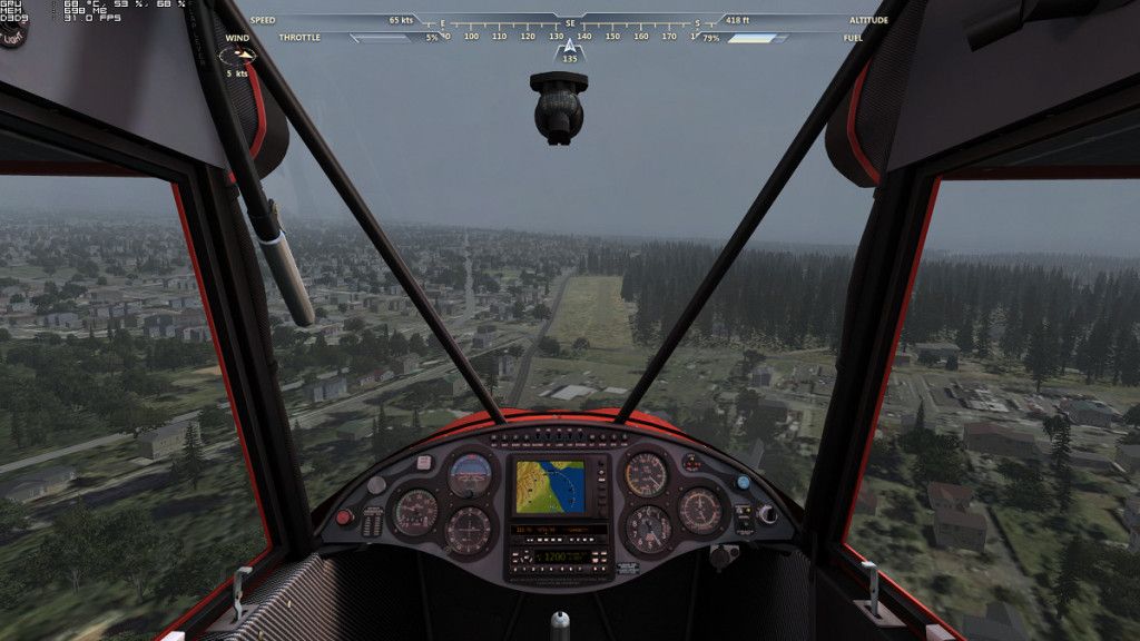
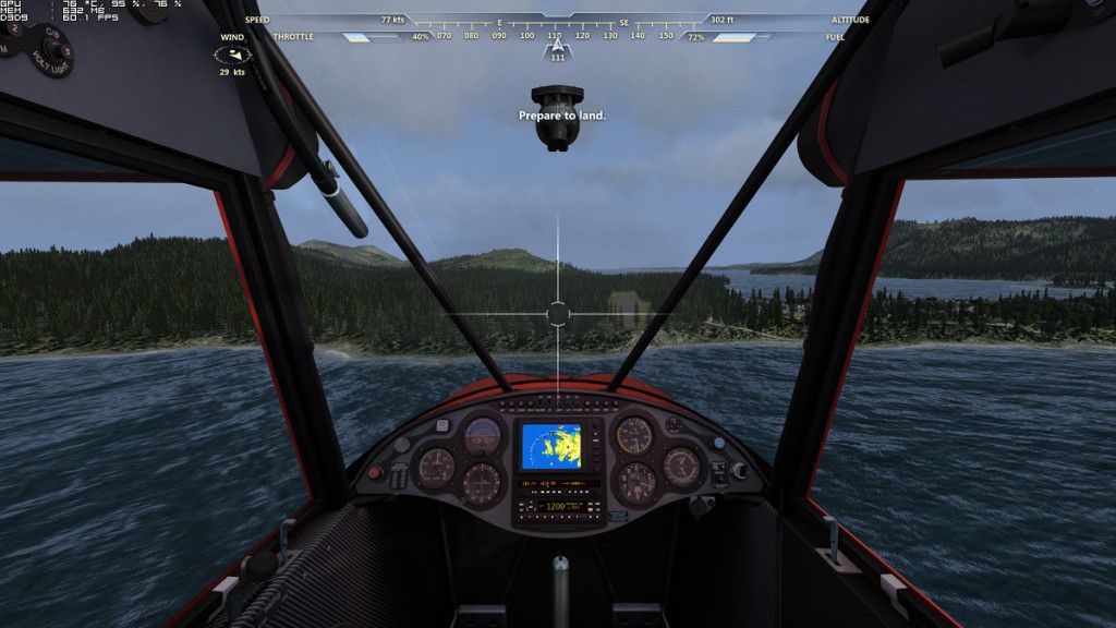
On the other hand, if, like me, you like to have fun, then just choose whatever Weather Theme suits your fancy and, when it comes time to land, fly a power-on landing, crabbing all the way down. I call this picture "The Alaska Crab."
By the way, I saw a video at Youtube of airline pilots landing in a storm with a vicious crosswind. It's well worth a look, as they come down crabbing these enormous jetliners:
I just wonder how many of the airliner simmers, who only do autolands at ILS-equiped runways, could hand-fly an airplane down in these conditions.
Best regards.
Luis
Not only are there trees, but also numerous hills, so the approach is somewhat steep. This isn't really a big problem with the Cub; it was made for that. But, I did notice in instances like this that often the other runway was clear of trees and other obstructions. Here is Kako from the other side:
Now, there have been some complaints about obstacles close to runways, but perhaps in some case it is simply a matter of choosing the right winds. With the correct wind for that part of Alaska, landings at Kako become (distressingly) easy.
And the same is valid for other places. This is Kodiak Municipal with the wrong Southerly winds that lead to landing over trees and buildings.
But, set the winds to the correct direction for this area, North/Northwesterly, and Short Final is over Lilly Lake (which, by the way, is the seaplane base) and landing is free of obstructions.
And one last example, Flying Crown, just because nothing in life is simple and straightforward. This strip is South of Anchorage and seems to be a private runway for the surrounding residents. The prevailing winds in Anchorage are nominally from the North, but then tall trees block the runway.
On closer study, winds in the area are from the North just half of the year, and during the Spring and Summer months they are from the South. So, set the winds differently and avoid the trees at Flying Crown.
(Just for your information, Flying Crown,from what I say in Google Street View, is surrounded by trees on all sides, so it's probably easier to take off and land there in Flight.)
And, of course, this leads directly to the question: what are the correct winds in Hawai'i and Alaska?
Well, Hawai'i is subject to the Trade Winds so we could expect them to be essentially from the Northeast. But, as I mentioned, life is never so simple. The majority of the islands do experience these winds, but the Big Island of Hawai'i has prevailing winds from the West/Southwest. And there are always monthly variations that can be different from the annual mean. Plus, coastal areas, and their airports, are subject to sea breezes in the daytime, and land breezes at night, that are often more important than the prevailing winds.
Generally, runways are laid out in such a way that they allow pilots to land with a headwind and as little crosswind as possible. So, just taking a look at the airport layout will usually be a good indication of prevailing winds.
But, it is always better to have more detailed and precise information.
Here is a table of prevailing winds in Hawai'i:
Source: Desert Research Institute - Western Regional Climate Center
www.wrcc.dri.edu/htmlfiles/westwinddir.html
And an illustrated map of the annual prevailing winds for easier understanding:
And the similar table for Alaska:
Source: Same as above
With the illustrated map of Alaska:
Well, that's good, now we know what the real winds are in each region, but how to set those winds in Flight? I did a very quick and imcomplete test of the various Weather Themes in both Hawai'i and Alaska and put together this simple table. It may or may not reflect all the conditions for each Theme, and the 2 new Alaskan Themes seem to have more variation than the original. But, for what it's worth, this table should give a good indication of the winds available in Flight:
So, if you are a "serious" simmer like me, then you will carefully plan your flights, examining the airport charts for both destination and arrival, and choosing the most appropriate Weather Theme.
If you will have any sort of crosswind, then you will want to take into account the Maximum Demonstrated Crosswind Component for the airplane of your choice. Now, first you have to be able to find out what it is, and that's not so simple, and then consider if you want to attempt to exceed that in case you have very strong winds. Also, remember that this is just a Demonstrated Crosswind, somebody, probably the test pilot, got up and flew in that crosswind to show it could be done.
I searched for the Maximum Demonstrated Crosswind Components for the principal airplanes in Flight, but only the Cubcrafters Cub has any indication of this in the Pilot Operating Handbook:
Carbon Cub - 11 kts
Yes, that's right, just 11 kts, so basically you will often exceed the Max Crosswind Component for the Cub.
Now, I could not find this speed for the other airplanes in Flight, but the FAA does stipulate that aircraft must be able to handle at least a crosswind representing 20% of Vso, (90° crosswinds up to a velocity equal to 0.2 Vso. This means a windspeed of two-tenths of the airplane’s stalling speed with power off and landing gear/flaps down), so here is Vso for the Flight airplanes:
Maule M7-260C Orion - Max Crosswind 12 kts (14 mph) Vso 40 mph
Stearman PT-17 - Vso 55 mph (48 kts)
RV-6A - Vso 45 kts
Icon A5 - Vso 45 kts (but who knows what this will turn out to be, since the airplane is still in development)
So, now you know what we must do, all us "serious simmers", in order to fly like the real thing.
On the other hand, if, like me, you like to have fun, then just choose whatever Weather Theme suits your fancy and, when it comes time to land, fly a power-on landing, crabbing all the way down. I call this picture "The Alaska Crab."
By the way, I saw a video at Youtube of airline pilots landing in a storm with a vicious crosswind. It's well worth a look, as they come down crabbing these enormous jetliners:
I just wonder how many of the airliner simmers, who only do autolands at ILS-equiped runways, could hand-fly an airplane down in these conditions.
Best regards.
Luis

