|
|
Post by bhk on Dec 7, 2007 18:18:24 GMT -5
|
|
|
|
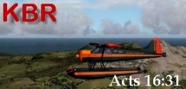
Post by kbr on Dec 7, 2007 18:26:28 GMT -5
Nice flight, Bruce. Looks like FSX is well suited for that area.
Could I ask what program you used for the map of your route?
|
|
|
|
Post by bhk on Dec 7, 2007 21:29:42 GMT -5
It's Google Maps, Kev. I find it very suitable for this type of thing because it provides alternatives for map or satellite views, the latter can be had with or without map overlay. Zoom in, zoom out, scroll......all very convenient. Just go to maps.google.com.  Bruce. |
|
|
|
Post by kbr on Dec 7, 2007 22:46:37 GMT -5
Thanks, Bruce. That'll come in handy. I recently found a link to a freeware xplane Madagascar adventure scenery package ( fb-artwork.de/MBA/scenery.html ) on one of the sites I buy Xplane planes at and I am thinking about heading there for some adventures one I finish my current flight from Vancouver to Juneau. Since my preferred flight planner (Golden Eagle Flight Prep) pretty much only covers North America, I've been keeping an eye out for anything that may be handy for helping me plan my flights there. By the way, I read in the readme, that the Xplane Madagascar scenery is based on Pierre Mogenet's (with his permission) FS9 scenery, which I think can be found at Avsim. |
|
|
|
Post by bhk on Dec 7, 2007 23:23:48 GMT -5
Mogenet's name rings a bell.....I'm sure I saw it when I was recently looking for an FSX mesh for Africa.
I like using Google Maps when I'm simming......I can have it open in the background or, in the case of FSX, have it open on the laptop next to me whilst I FSX on the desktop.
It's excellent for helping to develop Flights.
Cheers, mate!
Bruce
|
|